Thursday, April 5, 2007
Google My Maps
Google introduced a new feature to Google Maps: My Maps. The My Maps tab can be found at the left-hand side, and allows you to quickly create your own placemarks with information (including photos) as well as your own lines and shapes to mark areas. You can then share these maps with others on the web through a special link.
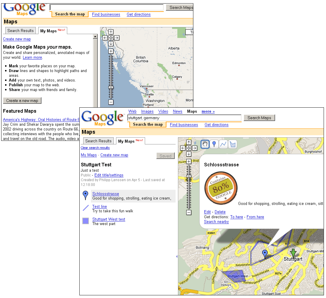
I’ve tried to create a first sample map to explore this feature. To do so, you hit the “My Maps” tab on Google Maps and click the “Create a new map” button. If you’re not logged in to your Google Account, you will now have to log-in. You can then add a title and description to your new map, and decide whether to have it be public or unlisted (“unlisted” doesn’t mean “completely secret” – we know this from Picasa Web Albums, which also has these two options). I’m going for public and call my map “Stuttgart Test”. Now I’m offered 4 different tools to edit the map: a hand tool to drag the map around, a placemark tool to drop new markers with information on the map, a line tool to create paths (like walking directions), and a rectangle tool to add shapes.
To share the page, I click the “save” button, and then pick the “Link to this page” link at the top right, ending up with a permalink URL like this one.
All in all, a very neat new feature. The ability to create placemarks and such isn’t new (Google Earth already allowed you to do this, and so did third-party web apps, to some extent), but it was never as easy as it is now... and I bet as a consequence, Google will get a lot of fresh and exclusive* data to chew on to optimize their mapping project. As with every user-edited place on the web, this new mapping data will also include a lot of spam (and data which is irrelevant or misleading for other reasons). I wonder if Google already figured out approaches to decide which part of the “public” data to make public indeed, i.e. display on the map even if users didn’t follow a special “shared” link. One possible approach is to identify overlapping data and only display information which reached a certain threshold; say, if 20 people in near proximity identify some place in San Francisco with the keywords “Chinese restaurant”, maybe it’s indeed relevant information to display to those who search maps for “Chinese Restaurant, San Francisco”.
Also see Google’s My Maps user guide.
*Even though the data can be added under the “public” option, it’s still exclusively hosted by Google. It’s important to distinguish between Google as “content owner” and Google as “content indexer”. Google indexes web results, but they don’t own the web pages, so competition can create their own tools to index web pages. However, everything you input into Google’s My Maps database cannot be directly accessed by Google’s competitors. Even when Google decides to offer some limited API export functionality for this data, that creates an important advantage you can’t replicate without replicating Google’s giant user base first (so when a competitor creates a map editing tool today that is just as good or even better than Google’s own tool, they don’t have a better product yet, which brings with it some interesting implications).
[Thanks Prashanth, Tommy Hunsaker, Frank Taylor and Reto Meier!]
>> More posts
Advertisement
This site unofficially covers Google™ and more with some rights reserved. Join our forum!