Wednesday, July 25, 2007
BBC Puts Floods on Google Maps
By Tony Ruscoe
Parts of the UK are currently suffering the worst floods in over 60 years. By using Google Maps, the BBC has created an interactive flood map showing flood warnings, emergency center locations, photos, videos and audio reports for Berkshire, which is one of the most severely affected areas.
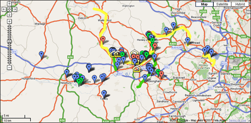
As the Google LatLong blog points out, “This is a great example of citizen journalism plus professional journalism, all mashed up on a map.”
>> More posts
Advertisement
Advertisement
This site unofficially covers Google™ and more with some rights reserved. Join our forum!