Friday, February 12, 2010
New: Google Maps Labs
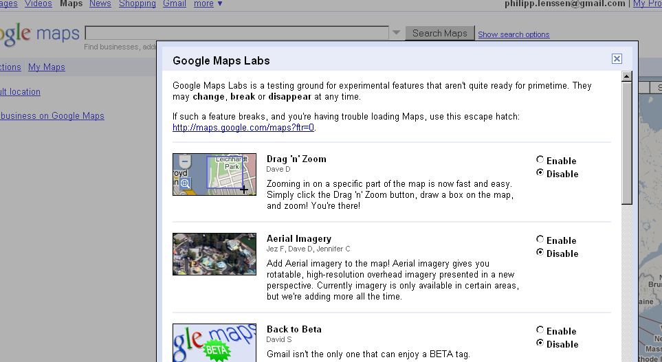
When Google wants to test new features, they call them Lab experiments, and make them opt-in. Now, following many other services, Google Maps received a Lab icon. Click the green flask at the top of Google Maps and you get a chance to enable features like the following:
- Drag ’n’ Zoom: Click the Drag-and-Zoom button, then draw a box on the map to immediately zoom into that place.
- Aerial Imagery: Available for certain areas, aerial imagery “gives you rotatable, high-resolution overhead imagery presented in a new perspective.”
- Back to Beta: This will simply add a “Beta” icon to the Maps logo.
- Where in the World Game: Guess the name of the country from satellite imagery.
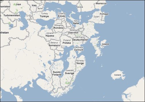
- Rotatable Maps: This puts north facing downwards, for instance.
- What’s Around Here?: This will trigger a search for anything (“*”), showing the top places for a given location.
- LatLng Tooltip: Shows the latitude/ longitude of where your cursor is positioned.
I kind of like the rotatable maps feature. You can rotate by using the top left compass. Here’s Europe:
[Thanks Hebbet!]
>> More posts
Advertisement
Advertisement
This site unofficially covers Google™ and more with some rights reserved. Join our forum!